Idaho Statehood: How the Gem State Became the 43rd Member of the Union on July 3, 1890
On July 3, 1890, President Benjamin Harrison sat at his desk in Washington, D.C., and signed the proclamation admitting Idaho to the Union as the forty-third state of the United States of America. It was a deliberate choice of date: Idaho’s advocates had pushed for July 3 rather than July 4 precisely so that the forty-third star could be added to the flag in time for Independence Day the following year. Had the signing been on July 4, the custom that required the flag to reflect the number of states as of the preceding July 4 would have meant waiting another full year for Idaho’s star to appear. In Boise, when the news arrived by telegram, the celebration that erupted filled the streets of the territorial capital with parades, bonfires, and the jubilant sounds of a community that had waited twenty-seven years as a territory for this moment. The Idaho Statesman reported that the heavens smiled upon the flag of freedom unfurled in honor of the newborn state.
The journey to statehood had been anything but smooth. Idaho’s path from wilderness to territory to state encompassed the full drama of the American West: the dispossession of Indigenous nations who had lived on its lands for thousands of years; the arrival of explorers, fur trappers, missionaries, and prospectors; the convulsions of the gold rush that transformed a few thousand settlers into a population demanding organized government; the political battles over Mormon polygamy that shaped the territorial period; and the complex machinations of national politics in which Idaho’s statehood became entangled with questions of party advantage and constitutional controversy. That Idaho arrived at statehood at all, given a congressional effort to dismember the territory between Washington and Nevada, was itself something of a near-miracle. But arrive it did, on July 3, 1890, and the Gem State — so called for the extraordinary variety of precious and semi-precious stones found within its borders — took its place in the American Union.
The First Peoples: Thousands of Years of Native American Life Before European Contact
Long before any European explorer set foot in the region that would become Idaho, its lands were home to Native American peoples whose presence stretched back at least 14,000 years. Archaeological excavations at Wilson Butte Cave near Twin Falls, conducted in 1959, revealed arrowheads and other artifacts that rank among the oldest dated human remains in North America. More recent findings at Cooper’s Ferry along the Salmon River in western Idaho near the town of Cottonwood has produced stone tools and animal bone fragments that may represent even older evidence of human habitation, potentially placing the earliest human presence in the region at 15,000 to 16,000 years ago, when migratory hunters pursued bison and mammoth across the landscape that the glaciers had only recently shaped.
By the time European explorers first arrived in the early nineteenth century, Idaho was home to several distinct Indigenous nations with deep territorial and cultural roots. In the northern panhandle region, the Coeur d’Alene, the Kootenai, and the Pend d’Oreille people occupied lands around the great lakes and river systems of the north. To the west and south, the Nez Percé — whose name was given to them by French Canadian trappers, though they called themselves the Nimiipuu, the Real People — inhabited an extensive territory stretching across what is now north-central Idaho, northeastern Oregon, and southeastern Washington. The Nez Percé were among the most sophisticated equestrian cultures of the Pacific Northwest, renowned horsemen whose Appaloosa horses were prized throughout the region. In the south and across the Snake River Plain, the Shoshone and their close relatives the Bannock occupied the vast sagebrush prairies and mountain valleys, while the Northern Paiute ranged across the southwestern reaches of the territory.
The Shoshone were particularly significant to Idaho’s history as the first Indigenous people to encounter the Lewis and Clark expedition, and their assistance would prove essential to the explorers’ survival. The Shoshone had been among the first Plains tribes to acquire horses, possibly as early as the seventeenth century, and the animals had transformed their culture, enabling more effective buffalo hunting and greater mobility across the difficult terrain of the Rocky Mountain region. By the time of European contact, approximately 8,000 Native Americans lived in the region that would become Idaho, occupying a land they had tended, hunted, fished, and gathered from for generations beyond counting. The arrival of Americans and Europeans would within a few decades shatter this world irreparably.
Lewis and Clark Enter Idaho: The 1805 Expedition That Opened the Northwest
Idaho holds the distinction of being the last of the fifty continental United States to be explored by people of European descent. The Lewis and Clark expedition, formally known as the Corps of Discovery, entered present-day Idaho on August 12, 1805, when Meriwether Lewis and a small advance party crossed Lemhi Pass on the continental divide from the present state of Montana. William Clark, leading the main party of the expedition, crossed through the Bitterroot Mountains a few days later. The journey through Idaho was one of the most arduous segments of the entire transcontinental expedition, and it would not have succeeded without the crucial assistance of the Shoshone and Nez Percé peoples.
The expedition’s Shoshone guide and interpreter, Sacagawea — a teenage Shoshone woman who had been taken captive as a child and sold to the Canadian trader Toussaint Charbonneau, who was her husband — proved invaluable in establishing friendly contact with the Shoshone bands they encountered in present-day Idaho. It was through Sacagawea’s negotiations that Lewis and Clark were able to obtain the horses they desperately needed to cross the mountains. After crossing into the Clearwater River drainage, the Corps of Discovery encountered the Nez Percé people, who helped the exhausted explorers build canoes from the great ponderosa pines of the valley. The expedition floated down the Clearwater River and then the Snake River to reach the Columbia River, which they followed to the Pacific Ocean. The return journey through Idaho in the spring of 1806 deepened the expedition’s knowledge of the region and further established the friendly relationships with the Nez Percé that would shape the early American presence in the Northwest.
The publication of Lewis and Clark’s journals opened the Northwest to the attention of American traders and entrepreneurs. Within a few years, Canadian explorer David Thompson, representing the North West Company, had built Kullyspell House near present-day Lake Pend Oreille in 1809, the first non-Native structure in the Pacific Northwest, establishing a fur trading post that connected the region to the global market for beaver pelts. Andrew Henry built Fort Henry in 1810. The fur trade brought American mountain men, French Canadian voyageurs, and British traders alike into the Idaho mountains and river valleys through the 1820s and 1830s. Fort Hall was established on the Snake River in 1834 by Nathaniel Wyeth, and Fort Boise, near the site of what would become the territorial and state capital, was established by the Hudson’s Bay Company in the same year. These trading posts became nodes in the network of trails that would eventually coalesce into the Oregon Trail.
Missionaries, the Oregon Trail, and the First Permanent Settlements in Idaho
The transformation of Idaho from a fur traders’ domain into a region of permanent settlement began with missionaries, whose ambitions to bring Christianity to the Native peoples of the Northwest preceded the arrival of farming settlers by decades. Henry Harmon Spalding and his wife Eliza Hart Spalding arrived among the Nez Percé at Lapwai Creek in 1836, establishing the first school in what would become Idaho and beginning a mission that operated for more than a decade. The Catholic missionary Father Pierre-Jean De Smet led a party to the Coeur d’Alene River in 1842, selecting the site for what would become the Cataldo Mission — a remarkable structure built without nails by the Coeur d’Alene people and Catholic missionaries, using the wattle and daub construction method. Completed in 1853, the Cataldo Mission is today the oldest standing building in Idaho, a remarkable testament to the cross-cultural collaboration that the mission enterprise sometimes, if not always, represented.
The Oregon Trail, the great overland emigrant route that funneled hundreds of thousands of Americans westward between the 1840s and the 1860s, passed directly through southern Idaho, following the Snake River plain for hundreds of miles. The first wagon train made the complete overland journey to Oregon in 1842, and for the next two decades, thousands of emigrants per year crossed what is now Idaho on their way to Oregon, California, and later Utah. The trails left ruts in the rock and soil of the Snake River plain that are still visible in places today, silent testimony to the volume of human traffic that moved through the region. Yet despite this constant passage, almost no one stopped to settle in Idaho itself during the 1840s and 1850s. The land seemed too remote, too arid in the south and too rugged in the north, too far from the markets and communities that settlers needed to make a permanent life.
The first truly permanent settlement in Idaho was established not by miners or homesteaders but by members of the Church of Jesus Christ of Latter-day Saints. In April 1860, a company of Mormon pioneers from Utah Territory, led by Thomas Smart, established the town of Franklin in the far southeastern corner of the present state, near the Utah border. The pioneers actually believed they were in Utah Territory at the time, and it was only later surveys that revealed they had crossed the border into what would become Idaho. June 15, the anniversary of their arrival, was later proclaimed Idaho Pioneer Day in 1911. These Mormon settlers planted the first crops in Idaho, including the potatoes that would eventually become the state’s most iconic agricultural product.
Gold Fever Transforms Idaho: The Discoveries That Created a Territory
The catalyst that transformed Idaho from a passage for emigrants and a home for a few missionaries into a land of mass immigration and organized government was gold. In the summer of 1860, Elias Pierce — known as E. D. Pierce, a former Indian agent — discovered placer gold on Orofino Creek in the Clearwater River country of northern Idaho, in the heart of the Nez Percé treaty lands. The discovery touched off the first of several gold rushes that would define the Idaho Territory’s early years. By 1861, thousands of miners had poured into the northern mountains, and the towns of Pierce and Orofino had sprung up in the wilderness seemingly overnight. The next year, gold was discovered in the Salmon River country, and then in August 1862 in the Boise Basin southeast of the present capital, where George Grimes led a prospecting party to the discovery that would produce what became known as the Boise Basin Gold Rush.
The pace of discovery was astonishing. Gold and silver were found along the Clearwater River in 1860, the Salmon River in 1861, the Boise River in 1862, and in the Owyhee River country near the Oregon border in 1863. Each discovery brought a new flood of miners, merchants, saloon keepers, gamblers, and all the other human types that the gold rush economy reliably attracted. The population of the region exploded from a few hundred permanent residents at the beginning of 1860 to tens of thousands by 1863. Towns appeared and grew with the fever speed of mining booms: Idaho City, at one point the largest city north of San Francisco and west of Denver, had a population of thousands in 1863. The Boise Basin mines were estimated to have produced as much as $250 million in gold and silver over their productive years.
This sudden explosion of population created an immediate administrative problem. The region that would become Idaho was nominally part of Washington Territory, but the territorial government in Olympia was hundreds of miles away across formidable mountain ranges, entirely incapable of maintaining order or providing governance for the chaotic mining camps. The solution came on March 4, 1863, when President Abraham Lincoln signed the Organic Act creating the Idaho Territory. The new territory was enormous: it encompassed all of present-day Idaho and Montana, and most of present-day Wyoming, an area larger than Texas. Lewiston, on the Clearwater River in the northern part of the territory near the Washington border, was named as the first territorial capital. The Idaho Territory was born in the middle of the Civil War, and Lincoln — overwhelmed with the demands of that conflict — could give it only the most minimal attention. The territorial legislature would largely be on its own.
The Territorial Period: Governors, Capital Controversies, and the Shrinking Territory
The Idaho Territory’s first years were marked by the characteristic disorder of frontier governance, complicated by the sheer size of the territory and the distances that separated its scattered communities. The first territorial governor was William H. Wallace, a Republican appointed by Lincoln, who took office in July 1863. Wallace served only briefly before moving on to become the territory’s congressional delegate, and a succession of governors followed, some capable and some not, all dealing with the fundamental challenge of governing an enormous and rapidly changing territory with minimal federal support. The capital at Lewiston proved problematic almost immediately: it was too far north to serve the rapidly growing southern mining communities around Boise and the Owyhee country, and the southern settlers began agitating almost from the start for a capital closer to the center of population.
The capital controversy was resolved in 1866 in a characteristically Idaho fashion: by a one-vote margin in the Territorial Supreme Court, the capital was moved from Lewiston to Boise. Lewiston residents were furious and refused for a time to surrender the territorial records, but the transfer eventually took place, and Boise — established in 1863 as a supply center for the mining camps and as a military post to protect the Oregon Trail — became the permanent capital of the Idaho Territory and eventually of the state. The city’s name derived from the French word for wooded, reflecting the welcome shade of the trees along the Boise River in the otherwise arid Snake River plain, and French Canadian trappers and explorers had given it the name decades earlier.
The Idaho Territory also shrank dramatically in its early years. Within a year of its creation, gold prospectors in the northeastern part of the territory persuaded Congress to carve out the Montana Territory in 1864. The following year, 1868, the southeastern portion of the Idaho Territory was organized as the Wyoming Territory. These territorial partitions reduced Idaho from its original enormous size to roughly the shape it has today, though even this reduced territory was still vast by eastern standards. The panhandle shape that defines Idaho on every map — the elongated northern section attached to a broader southern body — was largely the product of these territorial divisions, as the boundaries of Montana to the east and Washington to the north left a narrow corridor of Idaho extending northward to the Canadian border.
The Nez Percé War and the Subjugation of Idaho’s Native Nations
The influx of settlers that the gold rush brought to Idaho had devastating consequences for the Native peoples who had lived on these lands for thousands of years. As miners and settlers spread across the territory, they repeatedly violated the treaty boundaries that the federal government had negotiated with the various tribes, occupying lands supposedly reserved for Native use and disrupting the hunting, fishing, and gathering practices on which the tribes depended. The response of the federal government was to negotiate new treaties that progressively reduced the size of reservation lands, forcing tribes onto smaller and more remote territories to make room for the expanding settler population.
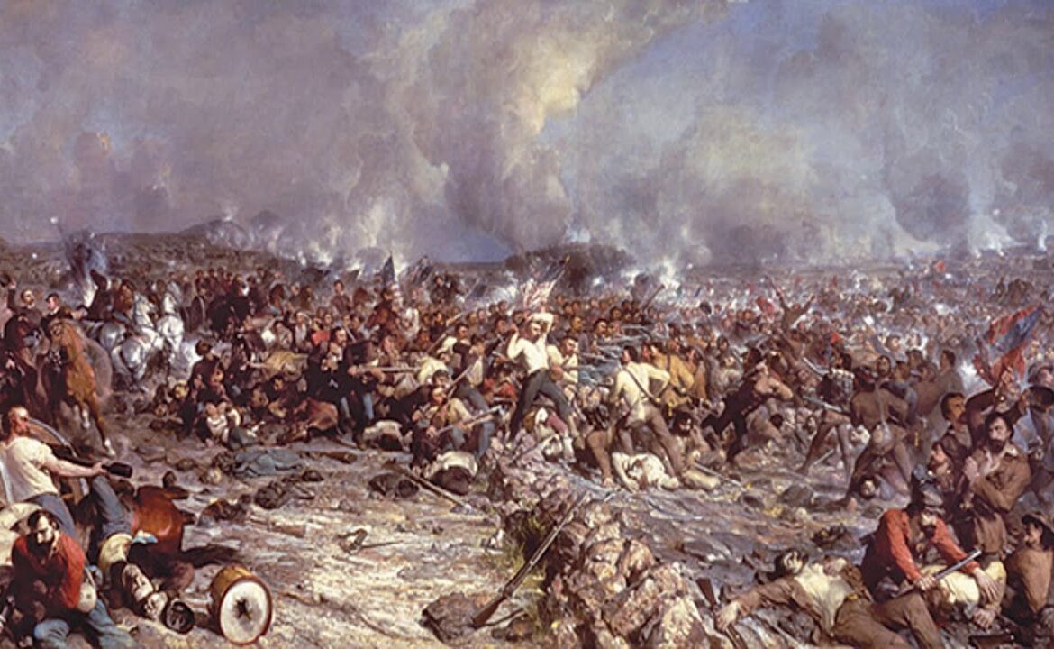
The most famous and most tragic episode of Idaho’s Native American history was the Nez Percé War of 1877. In June of that year, a group of non-treaty Nez Percé under the leadership of a collection of chiefs including the man known to Americans as Chief Joseph began a desperate attempt to flee to Canada rather than submit to confinement on a much-reduced reservation. Over the following four months, approximately 700 Nez Percé men, women, and children — of whom perhaps 200 were warriors — led the pursuing United States Army on a running fight across 1,170 miles of some of the most difficult terrain in North America. The campaign traversed Idaho, Montana, and Wyoming, with the Nez Percé winning several engagements against larger Army forces before being finally surrounded at the Bear Paw Mountains in Montana, just forty miles from the Canadian border. Chief Joseph’s surrender speech — I am tired of fighting. Our chiefs are killed. The old men are all dead. The children are freezing to death — became one of the most quoted and most heartbreaking documents of the American Indian experience.
Other conflicts marked the period as well. The Bannock War of 1878 saw the Bannock and Paiute peoples resist their confinement to the Fort Hall Reservation, where promised food supplies had not materialized and where the settlers’ pigs had been eating the camas roots that were a staple of the Bannock diet. The Sheepeater War of 1879 was a smaller but equally significant conflict, as a small band of mountain Shoshone resisted settlement of their high-altitude homeland. By the end of 1879, armed Native American resistance in Idaho was effectively over, and all of Idaho’s Native peoples had been confined to reservation lands. The process had been brutal, the dispossession nearly total, and its consequences — for the indigenous communities and for the moral character of the American project in the West — were profound and lasting.
Silver, Railroads, and the Growth That Made Statehood Possible
After the initial excitement of the gold rushes faded and the most accessible placer deposits were worked out, Idaho’s economic development continued through the exploitation of other mineral resources and through the infrastructure improvements that made long-distance commerce possible. Silver became increasingly important in the 1870s and 1880s. In 1880, significant lead and silver deposits were discovered in south-central Idaho. In 1884, the Coeur d’Alene mining district of northern Idaho produced what was eventually recognized as the nation’s largest silver deposit, with the discovery of the great mines around Wardner, Mullan, and the Bunker Hill area. The Coeur d’Alene Silver Valley would go on to produce hundreds of millions of dollars in silver, lead, and zinc over the following century, and the district would eventually be recognized as having produced more silver than any other place on earth.
The arrival of railroads was equally transformative for Idaho’s development. The Utah Northern Railroad, a line that the Mormon settler community had been instrumental in building, reached Franklin in the southern part of the territory in 1874. In 1884, the Oregon Short Line, a subsidiary of the Union Pacific, linked the booming silver mines in Hailey and the Big Wood River area with Oregon, opening the rich agricultural lands of the Snake River plain to commercial production for the first time. The following year, the Northern Pacific Railroad reached the northern panhandle, connecting the Coeur d’Alene mining district to markets in both the Pacific coast states and the eastern United States. These rail connections were essential preconditions for the economic activity that would sustain a state: without them, Idaho’s mines and farms could not profitably ship their products to distant markets, and without that commerce, the territorial population could not grow to the level required for statehood.
Agriculture also began to develop as a significant component of Idaho’s economy alongside mining, particularly in the fertile valleys of the south. The Snake River plain, watered by the great river that cut across it, offered rich volcanic soil that proved extraordinarily productive for farming once irrigation systems could bring river water to the otherwise dry land. Mormon settlers had been farming in southeastern Idaho since 1860, and had brought to that enterprise the cooperative irrigation traditions of the Utah settlements. Cattle ranching expanded across the territory, as herds were driven north from Texas to feed the growing mining communities and then stayed as ranchers recognized the quality of Idaho’s mountain grazing lands. Basque immigrants, who came to Idaho from the region between Spain and France beginning in the 1880s, became particularly prominent in the sheep industry, establishing a cultural presence in Idaho that persists to this day.
The Mormon Question: Polygamy, Disenfranchisement, and the Politics of Statehood
Among the most contentious issues that shaped Idaho’s path to statehood was the political conflict over the Mormon community in southern Idaho and the practice of plural marriage, or polygamy, that was at that time part of the doctrine of the Church of Jesus Christ of Latter-day Saints. Since 1860, when the Mormon pioneers had established Idaho’s first permanent settlement at Franklin, the Church had encouraged its members to migrate northward from Utah into the fertile valleys of southeastern and eastern Idaho. By the 1880s, a substantial portion of Idaho’s southern population was LDS, and these settlers voted overwhelmingly Democratic — partly because Democratic presidents had historically been more sympathetic to the Church’s interests and more inclined toward a moderate approach to the polygamy question than their Republican counterparts.
The political implications of Mormon voting power were significant. In 1884, Grover Cleveland, a Democrat, won the presidential election partly with the support of LDS voters in Idaho Territory who turned out in large numbers. Idaho Republicans, alarmed by the Democratic voting bloc that the LDS community represented, devised what became known as the Idaho Test Oath: a provision in the territorial law that barred any member of an organization that taught the practice of polygamy from voting, holding public office, or serving on a jury. The measure was explicitly targeted at LDS voters, even those who were not themselves polygamists, since their membership in a church that endorsed polygamy was enough to trigger the disqualification. The Test Oath was challenged in the courts and ultimately upheld by the United States Supreme Court in Davis v. Beason in 1890, the same year Idaho achieved statehood.
The Mormon question directly affected the timing and shape of Idaho statehood. Utah Territory, which had a larger population than Idaho and had been settled longer, was blocked from achieving statehood for decades precisely because its majority LDS population included polygamists, and Congress was unwilling to admit a state in which plural marriage was practiced. Idaho, with its strong anti-LDS political establishment, was able to achieve statehood some six years before Utah. The Idaho constitution of 1889 included explicit anti-polygamy provisions as one of its most prominent features, reflecting the political reality that demonstrating hostility to LDS practices was, in the political climate of the 1880s, a prerequisite for congressional approval of statehood. It was a cynical bargain in some respects, but it was effective: Idaho became a state in 1890, Utah not until 1896.
The Constitution of 1889, Governor Stevenson, and the Final Push for Statehood
The immediate prelude to Idaho statehood was a period of intensifying political activity in the late 1880s as national Republicans recognized the opportunity to add new western states that would reliably elect Republican senators and congressmen. The situation in 1888 was particularly favorable from the Republican perspective: Grover Cleveland, the incumbent Democratic president, had pocket-vetoed a bill that would have split Idaho between Washington Territory and Nevada, preserving Idaho’s territorial integrity and the possibility of a unified state. Benjamin Harrison, the Republican candidate, won the 1888 presidential election, and the Republican-controlled Congress began moving rapidly toward admitting a cluster of western territories as states.
Idaho’s territorial governor, Edward A. Stevenson, called for a constitutional convention in 1889. The convention assembled on the symbolic date of July 4, 1889 — Independence Day — and over the following weeks drafted a constitution for the proposed state of Idaho. The convention produced a document that reflected both the democratic aspirations of the western frontier and the specific political realities of Idaho in 1889. The constitution established a framework of government that consciously dispersed executive power among multiple independently elected officials — the governor, secretary of state, state controller, state treasurer, attorney general, and superintendent of public instruction were all to be separately elected, reflecting the frontier distrust of concentrated authority that characterized western political culture. The constitution explicitly prohibited polygamy and disenfranchised those who practiced it, addressing the Mormon question in terms that Congress required.
The voters of Idaho Territory ratified the constitution on November 5, 1889, by a strong majority. The following months saw intensive lobbying in Washington as Idaho’s congressional delegate and other advocates pressed for swift admission. The Idaho constitution made its way through the relevant congressional committees, and President Benjamin Harrison — who had come to office specifically committed to the expansion of Republican political power through western statehood — signed the enabling legislation on July 3, 1890. Idaho was admitted to the Union as the forty-third state of the United States. The date was chosen one day before Independence Day so that Idaho’s forty-third star could be added to the flag for the celebrations on July 4, 1891. As Governor Brad Little of Idaho explained more than a century later: You know why we picked July 3rd instead of July 4th? Because if we had picked July 4th, the addition of the 43rd star to the flag wouldn’t have been until a year later.
President Benjamin Harrison and the Admission of Idaho: The Political Context of 1890 Statehood
The president who signed Idaho into statehood, Benjamin Harrison, was himself a figure of considerable historical interest, the grandson of William Henry Harrison, the ninth president who had died of pneumonia just thirty-one days into his term in 1841. Benjamin Harrison, born August 20, 1833, in North Bend, Ohio, had served as a Union general in the Civil War, rising to the rank of brevet brigadier general, and had been elected to the United States Senate from Indiana in 1881. He won the presidency in 1888 against the incumbent Grover Cleveland in one of the most closely contested elections in American history: Cleveland won the popular vote but Harrison won the Electoral College, making Harrison’s election one of only a handful in American history in which the popular vote winner lost the presidency.
Harrison’s approach to western statehood was explicitly partisan and thoroughly deliberate. In his administration’s first year, 1889, Harrison oversaw the admission of North Dakota, South Dakota, Montana, and Washington as states — four new states in a single year, all reliably Republican in their political orientation. Idaho and Wyoming followed in 1890, giving the Harrison administration an extraordinary record of territorial expansion into statehood. The Republican strategy was transparent to contemporaries: each new western state added two Republican senators to the chamber, strengthening the party’s hold on the Senate at a time when its House majority was uncertain. Idaho’s admission as the forty-third state was thus as much a product of national partisan strategy as of Idaho’s own readiness for self-governance, though the territory had by 1890 clearly reached the level of population and institutional development that statehood required.
Idaho’s First Governor and the New State’s Immediate Challenges
George L. Shoup became Idaho’s first governor upon admission to statehood, but his tenure proved remarkably brief. Shoup had been the last territorial governor of Idaho, having been appointed by President Harrison to replace Governor Stevenson, and his continuity in office provided an element of stability during the transition from territorial to state government. But within a few weeks of statehood, Shoup resigned the governorship to accept appointment to the United States Senate, making him one of the first two senators from the newly admitted state. Norman B. Willey succeeded him as governor. The first congressional representative from Idaho was Willis Sweet, a Republican who would serve from 1890 to 1895 and who became a prominent advocate for the free coinage of silver — the great monetary debate of the 1890s that pitted the interests of silver-mining states like Idaho against the eastern financial establishment’s commitment to the gold standard.
The state that Shoup and his successors governed in 1890 had a population of 88,548 people — modest by the standards of the long-settled East but sufficient to meet the constitutional requirements for statehood, and reflecting a significant growth from the handful of permanent residents who had preceded the gold rush three decades earlier. Boise, the capital, was a small but growing city. The mining communities of the Coeur d’Alene district in the north were among the most economically significant in the Pacific Northwest. The agricultural valleys of the south were beginning to develop the irrigation-based farming that would eventually make Idaho’s Snake River plain one of the most productive agricultural regions in the world. But statehood brought with it challenges as well as celebrations, and Idaho’s first years as a state were troubled ones.
The most immediate crisis of the new state’s early years came from the mining districts of the north. The discovery of the great silver deposits in the Coeur d’Alene had attracted not only the mines themselves but all the labor and capital conflicts that mining inevitably generated. In 1892, a dispute between union and non-union miners erupted into violence in the Coeur d’Alene region, as union members of the Western Federation of Miners confronted mine owners who had brought in non-union workers. The violence included the use of dynamite, firearms, and organized attacks on mine facilities, producing a situation of near-civil-war in the mining district. Governor Norman Willey declared martial law and called on President Harrison to send federal troops. The conflict subsided but was not resolved, and it would flare up again in 1899, when Governor Frank Steunenberg again declared martial law in the Coeur d’Alene — and when Steunenberg’s own assassination by a bomb in 1905 led to one of the most famous murder trials of the Progressive Era, with the labor lawyer Clarence Darrow defending the accused union organizer.
The Gem State’s Name, Seal, and the Symbols of Idaho’s Identity
The name Idaho itself has a curious and contested origin that became apparent only after the state’s identity had been established under that name for decades. In the early 1860s, when Congress was considering organizing a new territory in the Rocky Mountain region, a businessman and mining promoter named George M. Willing lobbied for the name Idaho, claiming that it was derived from a Shoshone phrase meaning gem of the mountains. The claim was compelling and the name was attractive, and Idaho began appearing on maps and in newspapers throughout the region. By the time Congress investigated the linguistic claim more carefully and determined that Idaho was most likely not an authentic Shoshone word at all but rather an invented term promoted by Willing, the name had already attached itself too firmly to be changed. The region of Colorado that had been briefly called Idaho reverted to other names, but the territory in the Pacific Northwest kept the name and eventually carried it into statehood.
The state seal of Idaho holds a particular distinction in American heraldry: it is the only state seal in the United States designed by a woman. Emma Edwards Green, who had studied art in New York, entered and won a competition sponsored by the first Idaho Legislature in 1891, her design featuring a central shield bearing a variety of Idaho symbols — a miner representing the mining industry, an elk head for wildlife, a sheaf of grain and a cornucopia for agriculture, and a steamship on the Shoshone River — flanked on the left by a woman representing liberty and justice and on the right by a miner. The figures are accompanied by representations of the state’s natural resources and industry, and the whole is surmounted by the state motto Esto Perpetua, a Latin phrase meaning It is perpetuated or May it endure forever. The seal was formally adopted by the legislature on March 14, 1891, and Governor Willey awarded Green the honorarium for her design on March 5.
Idaho’s official nickname, the Gem State, reflects both the invented etymology of the state’s name and the genuine reality of its mineral wealth. The state’s geology has produced seventy-two varieties of precious and semi-precious stones, including garnets found nowhere else on earth in their natural setting as they are in the northern Clearwater region, where they can be found embedded in the creek beds and hillsides. Star garnets — rare six-pointed and twelve-pointed stones created by the unique geological conditions of the Emerald Creek area — are found in only two places in the world: north-central Idaho and India. The mining of gold and silver that first drew settlers to the territory has been complemented over the years by the production of phosphate, cobalt, and numerous other minerals, making the Gem State nickname a modest but accurate description of one of the state’s genuine distinctions.
From Territory to State: The Significance of July 3, 1890 in American History
Idaho’s admission as the forty-third state on July 3, 1890 was part of a remarkable burst of nation-building in the American West that transformed the political map of the United States in the final decade of the nineteenth century. In the two-year period from 1889 to 1890, six new western states were admitted to the Union: North Dakota and South Dakota on November 2, 1889; Montana on November 8, 1889; Washington on November 11, 1889; Idaho on July 3, 1890; and Wyoming on July 10, 1890. No other two-year period in American history before or since has seen so many new states admitted so rapidly. The process reflected both the genuine maturation of these western territories into communities capable of self-governance and the explicit partisan strategy of the Harrison administration and the Republican Congress to extend Republican political dominance into the West before the inevitable Democrat counter-reaction in the 1890 midterm elections.
For Idaho specifically, statehood represented the culmination of a twenty-seven-year territorial period that had been marked by rapid and often chaotic development. The territory had gone from a population of under 17,000 at its creation in 1863 to 88,548 at statehood in 1890, a growth driven primarily by mining, with secondary contributions from agriculture, ranching, and the service industries that supplied the mining economy. The institutional infrastructure required for statehood — courts, schools, roads, postal services, banks, newspapers, and the other elements of a functioning civil society — had been built out across the territory during those twenty-seven years, imperfectly and unevenly but sufficiently. The constitutional convention of 1889 had produced a workable frame of government, and the voters had approved it with confidence.
The choice of July 3 for the statehood signing was not merely logistical but symbolically resonant. One day before the anniversary of American independence, Idaho’s admission to the Union connected the newest state to the founding ideals of the republic, even as the circumstances of that admission — the partisan calculations, the anti-Mormon provisions, the dispossession of Indigenous peoples whose lands had been incorporated without their consent — reminded the historically honest observer that the American story was never as clean as its symbols suggested. The Idaho Statesman’s celebration of the young giantess standing alone in her independence captured the aspiration; the labor violence in the mining districts and the confined Native peoples on their reservations captured the reality. Both were part of the state that Benjamin Harrison signed into existence on July 3, 1890.
Idaho’s Legacy: Potatoes, Politics, and the Gem State’s Place in American History
In the more than 130 years since statehood, Idaho has grown and diversified far beyond the mining and ranching territory that Harrison’s signature brought into the Union. The state’s population grew from 88,548 in 1890 to 1,839,106 in the 2020 census, a twenty-fold increase that reflected waves of immigration, agricultural development, and eventually the diversification of the state’s economic base into manufacturing, technology, and services. The Snake River plain, transformed by the great irrigation projects of the early twentieth century — including the Milner Dam completed in 1905, which brought water to 60,000 acres of previously unproductive land — became one of the most productive agricultural regions in the world, supplying not just potatoes but wheat, barley, sugar beets, hops, dairy products, and trout to national and international markets.
Idaho’s potatoes deserve particular mention as they became the state’s most iconic product and a fixture of American food culture. First planted in southern Idaho in the 1860s by LDS settlers who brought seed potatoes north from Utah, the potato thrived in Idaho’s volcanic soils and cool mountain nights, producing tubers of exceptional size, density, and starch content that proved ideal for baking, frying, and processing. By the mid-twentieth century, Idaho had become the nation’s leading potato-producing state, a position it has maintained ever since, accounting for approximately one-third of the total national potato yield. The Idaho potato became so closely associated with quality that the name itself became a marketing asset, and the Idaho Potato Commission, established in 1937, has spent decades defending and promoting that association.
Politically, Idaho has been a strongly Republican state since statehood, reflecting the anti-Democratic orientation of the mining communities and the ranching West that dominated the state’s early politics. The Republican Party’s dominance has been interrupted only rarely: a brief Democratic ascendancy during the New Deal era of the 1930s, when the Depression devastated the agricultural economy, and a more extended period of Democratic governors from 1971 to 1995, when Cecil Andrus served four terms and led a more moderate political era. The state’s congressional delegation has been a Republican stronghold for decades. Idaho’s political culture continues to reflect the frontier values of individual autonomy, suspicion of federal power, and resistance to regulation that characterized the territory and the early state.
Conclusion: The Gem State at 135 and the Meaning of July 3, 1890
The admission of Idaho as the forty-third state of the United States on July 3, 1890 was both a local event and a national one. Locally, it completed a journey from the pristine wilderness that Lewis and Clark had entered in 1805 through the explosive chaos of the gold rush to the organized community that the constitutional convention of 1889 had mapped out. Nationally, it was one stroke in the broad brush with which Benjamin Harrison’s administration was painting the American West Republican, one more star in the forty-four-point constellation that the flag would display after Wyoming’s admission one week later.
The names associated with Idaho’s path to statehood form a roster of American history in miniature: Meriwether Lewis and William Clark, whose expedition opened the Northwest to American ambition; Sacagawea, whose knowledge and diplomacy made their passage possible; E. D. Pierce, whose gold discovery in 1860 set off the chain of events that made territorial organization necessary; Abraham Lincoln, who signed the Territorial Act on March 4, 1863; Chief Joseph, whose surrender speech gave voice to the human cost of the American expansion that statehood represented; and Benjamin Harrison, who signed the enabling legislation on July 3, 1890, and whose partisan calculations aligned with Idaho’s genuine readiness for self-governance to produce the Gem State.
Idaho today bears all the marks of this complex history in its landscape, its culture, its economy, and its politics. The Nez Percé National Historical Park preserves the memory of the people whose lands were incorporated without consent. The Cataldo Mission still stands on its bluff above the Coeur d’Alene River, the oldest building in the state. The ruts of the Oregon Trail are still visible in the volcanic rock of the Snake River plain. And on July 3 of every year, Idahoans who choose to commemorate the anniversary of their statehood can reflect on what it meant, and what it cost, for a territory carved from lands that had belonged to Indigenous peoples for ten thousand years to become, on a summer day in 1890, the forty-third star in the American flag.